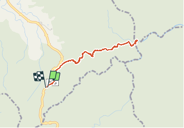
![](/images/other/stat-length.png)
![Trail Walking Le Morne-Rouge - Trace des Jésuites - Photo](https://media.geolcdn.com/t/1900/400/20a7cdb5-63b7-4fc2-90a5-e7ffe952a822.jpg&format=pjpeg&maxdim=2)
Trace des Jésuites
GabyG
User GUIDE
![Length](/images/other/stat-length.png)
![Max alt](https://static1.geolcdn.com/siteimages/upload/files/1508320355ic_sort_altitude_max_24dp.png)
![Uphill gradient](https://static1.geolcdn.com/siteimages/upload/files/1508320355ic_sort_den_pos_24dp.png)
![Km-Effort](/images/other/stat-length.png)
![Min alt](https://static1.geolcdn.com/siteimages/upload/files/1508320355ic_sort_altitude_min_24dp.png)
![Downhill gradient](https://static1.geolcdn.com/siteimages/upload/files/1508320355ic_sort_den_neg_24dp.png)
![Boucle](https://static1.geolcdn.com/siteimages/upload/files/16400158638029165_repeat_loop_refresh_sync_direction_icon.png)
![Walking](https://static1.geolcdn.com/sitytour/trail-icons/101.png)
2h05
Difficulty : Medium
![Scan this QR Code to open this trail in the SityTrail application](https://capi.geolives.com/qq0zvz2zws4bq2lad0pu/sitytour/trails/2743639/qr.png?size=200)
FREE GPS app for hiking
About
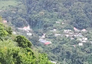
Trail Walking of 5.2 km to be discovered at Martinique, Unknown, Le Morne-Rouge. This trail is proposed by GabyG.
Description
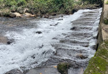
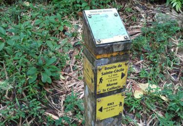
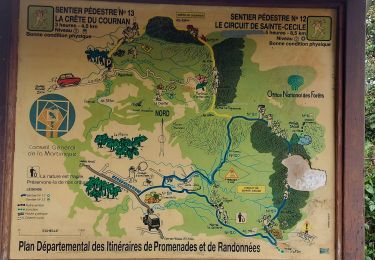
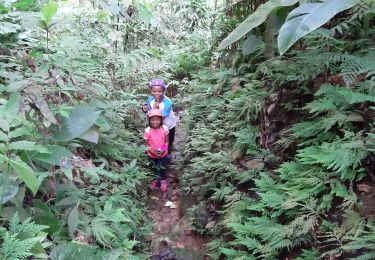
Randonnée sportive et balade avec bain de rivière. Cette randonnée propose plusieurs possibilités ! Deux tronçons de 5,5 km entre le Morne rouge et le gros morne. Avec traversé de rivière. possible avec 2 véhicules, 1 sur la RD1, et l'autre sur la RN3 pour démarrer la randonnée. Ou chaque tronçon menant à la rivière du Lorrain en Aller/Retour. N'oublier pas le petit bain de rivière qui est très rafraichissant.
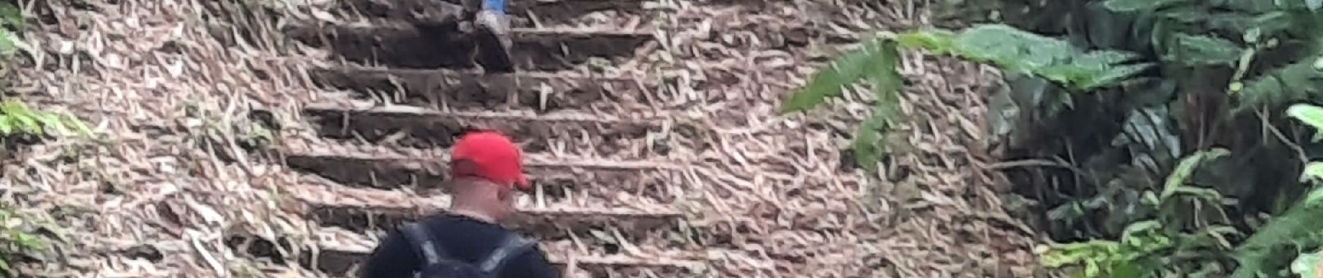
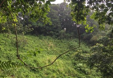
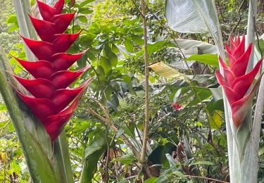
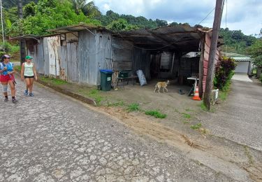
Positioning
Comments
Trails nearby
![Trail Walking Le Morne-Rouge - Sainte Cécile/crête du Cournan/Beauvallon - Photo](https://media.geolcdn.com/t/375/260/0cdc997b-416c-4503-a132-9262284ca457.jpg&format=jpg&maxdim=2)
![Walking Walking](https://static1.geolcdn.com/sitytour/trail-icons/101.png)
Walking
![](/images/other/stat-length.png)
![](https://static1.geolcdn.com/siteimages/upload/files/16400158638029165_repeat_loop_refresh_sync_direction_icon.png)
![Trail Walking Le Morne-Rouge - Mac Intoch - Morne Capot - Photo](https://media.geolcdn.com/t/375/260/ext.jpg?maxdim=2&url=https%3A%2F%2Fstatic1.geolcdn.com%2Fsiteimages%2Fupload%2Ffiles%2F1553511878bg_sport_marche.png)
![Walking Walking](https://static1.geolcdn.com/sitytour/trail-icons/101.png)
Walking
![](/images/other/stat-length.png)
![](https://static1.geolcdn.com/siteimages/upload/files/16400158638029165_repeat_loop_refresh_sync_direction_icon.png)
![Trail Walking Fonds-Saint-Denis - Fonds saint Denis (Martinique) - Photo](https://media.geolcdn.com/t/375/260/ext.jpg?maxdim=2&url=https%3A%2F%2Fservices.sitytrail.com%2FGeolivesWS%2FDownloadMedia.ashx%3FTrailID%3D897741%26Media%3D20180130144253.jpg)
![Walking Walking](https://static1.geolcdn.com/sitytour/trail-icons/101.png)
Walking
![](/images/other/stat-length.png)
![](https://static1.geolcdn.com/siteimages/upload/files/16400158638029165_repeat_loop_refresh_sync_direction_icon.png)
![Trail Walking Le Morne-Rouge - Morne la Caillerie, Trace des Jésuites - Photo](https://media.geolcdn.com/t/375/260/abb38c99-0268-4a50-8168-7a2f566fbedf.jpg&format=jpg&maxdim=2)
![Walking Walking](https://static1.geolcdn.com/sitytour/trail-icons/101.png)
Walking
![](/images/other/stat-length.png)
![](https://static1.geolcdn.com/siteimages/upload/files/16400158638029165_repeat_loop_refresh_sync_direction_icon.png)
![Trail Walking Fonds-Saint-Denis - Fonds st Denis - Photo](https://media.geolcdn.com/t/375/260/36793758-779d-4b0a-9402-46d88c044d08.jpg&format=jpg&maxdim=2)
![Walking Walking](https://static1.geolcdn.com/sitytour/trail-icons/101.png)
Walking
![](/images/other/stat-length.png)
![](https://static1.geolcdn.com/siteimages/upload/files/16400158638029165_repeat_loop_refresh_sync_direction_icon.png)
![Trail Walking Le Morne-Rouge - Crête du Cournan boucle - Photo](https://media.geolcdn.com/t/375/260/0c296f5b-819e-48af-b83c-d8f8f993e809.jpg&format=jpg&maxdim=2)
![Walking Walking](https://static1.geolcdn.com/sitytour/trail-icons/101.png)
Walking
![](/images/other/stat-length.png)
![](https://static1.geolcdn.com/siteimages/upload/files/16400158638029165_repeat_loop_refresh_sync_direction_icon.png)
![Trail Walking Le Morne-Vert - Trace Ti Jadin - Photo](https://media.geolcdn.com/t/375/260/3605b413-cbf4-425a-83cb-a870f6ded4a5.jpg&format=jpg&maxdim=2)
![Walking Walking](https://static1.geolcdn.com/sitytour/trail-icons/101.png)
Walking
![](/images/other/stat-length.png)
![](https://static1.geolcdn.com/siteimages/upload/files/16400158638029165_repeat_loop_refresh_sync_direction_icon.png)
![Trail sport Le Morne-Vert - Morne vert - Photo](https://media.geolcdn.com/t/375/260/08cf45e5-b64f-4338-9c76-38fd8ab1ca34.jpg&format=jpg&maxdim=2)
sport
![](/images/other/stat-length.png)
![](https://static1.geolcdn.com/siteimages/upload/files/16400158638029165_repeat_loop_refresh_sync_direction_icon.png)
![Trail Walking Le Morne-Vert - Montjoly, jardins pays, quartier Bernadette - Photo](https://media.geolcdn.com/t/375/260/6d1aecf6-7bd0-4ba7-a209-b0ef1e4aedb2.jpg&format=jpg&maxdim=2)
![Walking Walking](https://static1.geolcdn.com/sitytour/trail-icons/101.png)
Walking
![](/images/other/stat-length.png)
![](https://static1.geolcdn.com/siteimages/upload/files/16400158638029165_repeat_loop_refresh_sync_direction_icon.png)